[Wander Washington] Welcoming Spring at Mount Tahoma

“The clearest way into the Universe is through a forest wilderness.”

John Muir
May be an image of tree and nature

Growing up in California, I was invariably spoiled by beach days and Summer weather seemingly all year round; but as I’ve gotten older, I’ve found myself more and more enjoying the variation in seasons that Oregon and Washington have to offer. I tend to forget how much of California is a true desert, how the Summer season reaches into the Fall and touches Winter, scorching the Earth beneath it; proof that the grass is greener where it’s simply watered.

Now that I’ve had a foothold in the Pacific North West for a few years, I’ve found that it suits me – trees as tall as skyscrapers around every corner, wildflowers ushering in the Spring and then the Autumn leaves giving us a second dose of color in the Fall – and Winter, oh -how I do love me a good snow storm (something I’m sure I would have never said in Los Angeles!). It’s inspiration to get into the great outdoors every chance we can, especially when there are so few people on the trails and in the parks compared to how densely populated literally all the things were in Southern California.

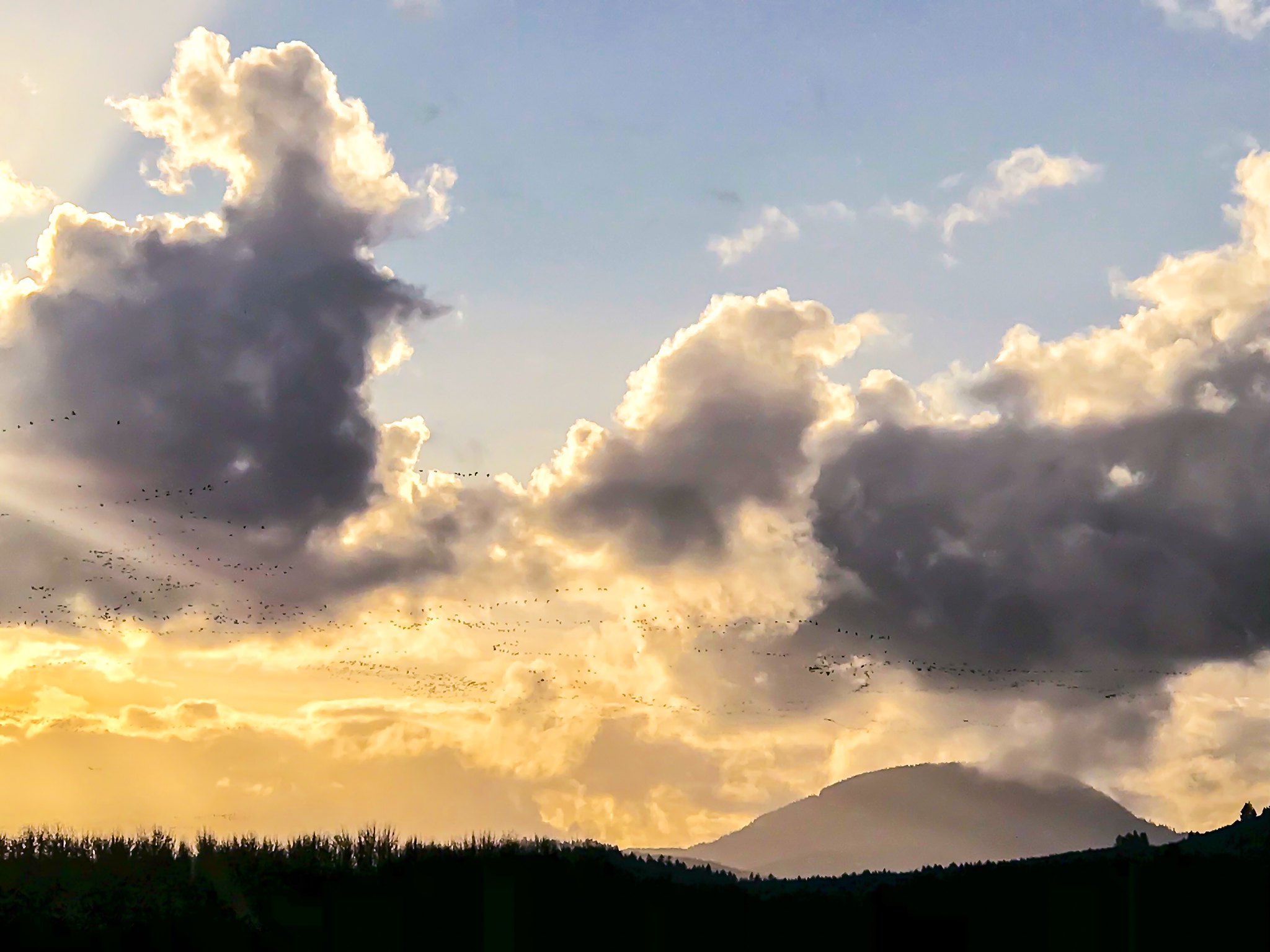
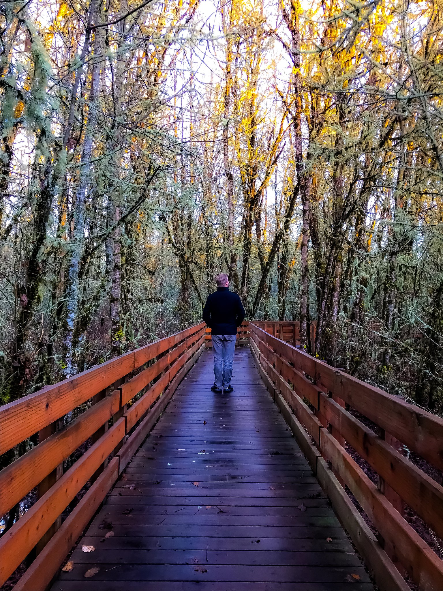
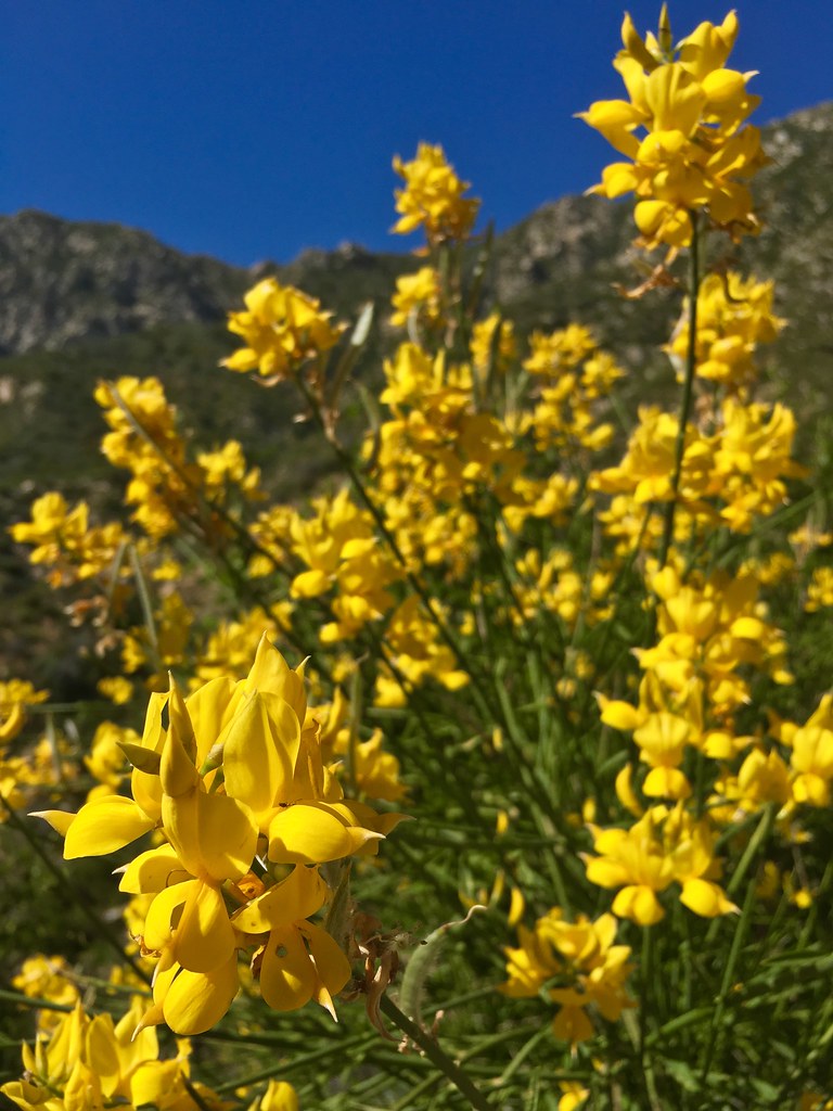
Lately, days and nights are inching longer, while the sunlight dances through trees to wake us up politely and set us to slumber sweetly; oh, yes – Spring is here, and it’s a delicate beauty all unto itself. Spring in Washington isn’t without rain, but it’s the type of rain that comes quietly in the night and leaves dew drops as it goes with the morning sun. Each day, you can see the sun maneuvering a new pathway from East to West, dipping into the Pacific Ocean in a glorious reverie of technicolor light, bouncing off of clouds and trees to illuminate the landscape. Offering a perfect invitation to get outside, and explore until your wanderlust has been quenched – at least, for the moment. For the most part, that means frequenting a park at dusk or getting in a late morning walk around Twin Ponds, but last weekend we had a chance to get out to Mount Tahoma, and let me tell you – Spring hits something different there.


The last time I was at Mount Tahoma, it was a gloriously sunny September morning and the weather hadn’t yet kicked into Autumn. The wildflowers around Paradise were bright and vibrant, almost like a second Spring had sprung – while the fog crept in on little cat feet around the base of the mountain. As a side note, though we know it now as Mount Rainier, past indigenous tribes proudly remember and revere it as Tahoma, or Tacoma – and it’s only proper to me that we try and bring these names back into the fold. An active stratovolcano, Mount Tahoma is located about sixty miles southeast of Seattle and may as well be the unofficial mascot of the Pacific North West, right next to Sasquatch. Before we get into my latest adventures, here’s a little geology lesson on the area:

Made of alternating layers of lava, ash and pyroclastic ejecta flows, Mount Rainier effortlessly towers over the rest of the Cascade Mountain Range with 26 major glaciers and 36 square miles of permanent sparkling snowfields, earning its status as the most glaciated mountain peak in the contiguous United States. At the top of the summit, the geothermic heat spewing from a duo of volcanic craters prevents the rims from getting snowed in or iced over, forming the world’s largest glacial cave network of ice-filled craters. While the current top formation of Tahoma is estimated to be approximately 500,000 years old, the mountain and the entire Cascade Volcanic Arc is considered part of the ‘Lily Formation’ and spans from roughly 840,000 years old to a whopping 2.6 Million years old. Though small eruptions have happened since with a frequency of every few hundred years, the last major eruption of Rainier was about 1000 years ago. (for more, check out my post from a few years ago on the Magic and Majesty of the Mountain.)


May be an image of tree and nature

Travelling definitely looks a bit different a year into quarantine and COVID, and it wasn’t lost on us how much time and effort everyone has put in to being healthy and safe in Washington. Thankfully, we had our second vaccine shot just before the weekend and it was a breath of fresh air knowing that as of April 15th, the rest of the state of Washington was finally eligible for their shots as well.

Believe you me, We still had our masks on us, and used them in areas outdoors that were too densely populated and we couldn’t keep six feet apart, or whenever we were indoors – but that was few and far between. For the most part, we were the only ones on the trails, barely even seeing a soul until we managed to find some scenic vistas and viewpoints of Tahoma; and the same went for indoors – because the weather turned lush so quickly, many people didn’t make it out to the mountain last weekend. Maybe it’s my natural personality showing, or maybe I’ve just become slightly agoraphobic over the last year but I really loved the feeling of ‘having the park for ourselves’, and it felt so good to let my face be free.

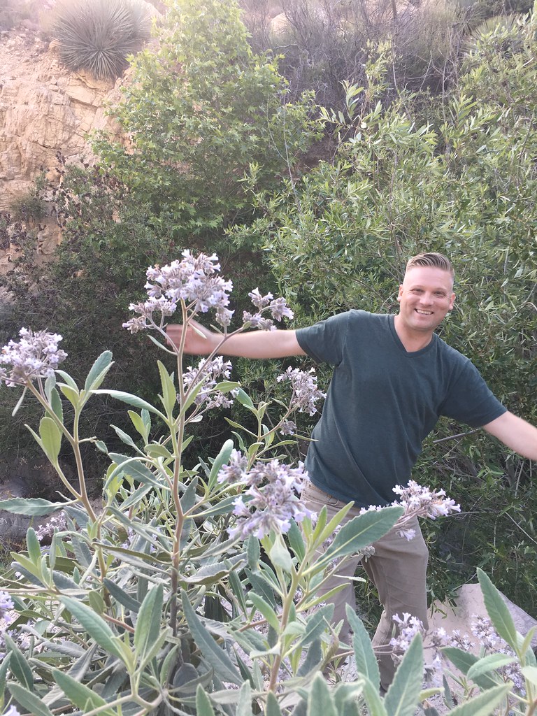
The last time I adventured around the mountain, I came with Danny and my parents; we took a day trip, and tried to see as much as we could around the Northern and Western rims of the mountain. This time, Danny and I took a different approach – staying at the base of the Cascade Mountain Range. Sitting right between Tahoma and Mount Saint Helens, and within a quick jaunt to the White Pass Ski Resort – Packwood is a tiny, 300 person town called just off the Cowlitz River – full of wildflowers, Elk and sprawling scenery.

May be an image of 2 people, tree and nature

When I booked lodging for the weekend, the weather had predicted clear skies but only at about 20-30°F; at the time, I said fuck it. If there’s one thing I’ve learned in Washington, it’s that you cannot simply stay indoors because of the weather rpoert, if you did you would miss out on SO much! That wisdom came to fruition as we pulled into Packwood; feeling incredibly grateful and lucky, because the temperatures broke clear into 80° territory and there wasn’t a cloud in sight.

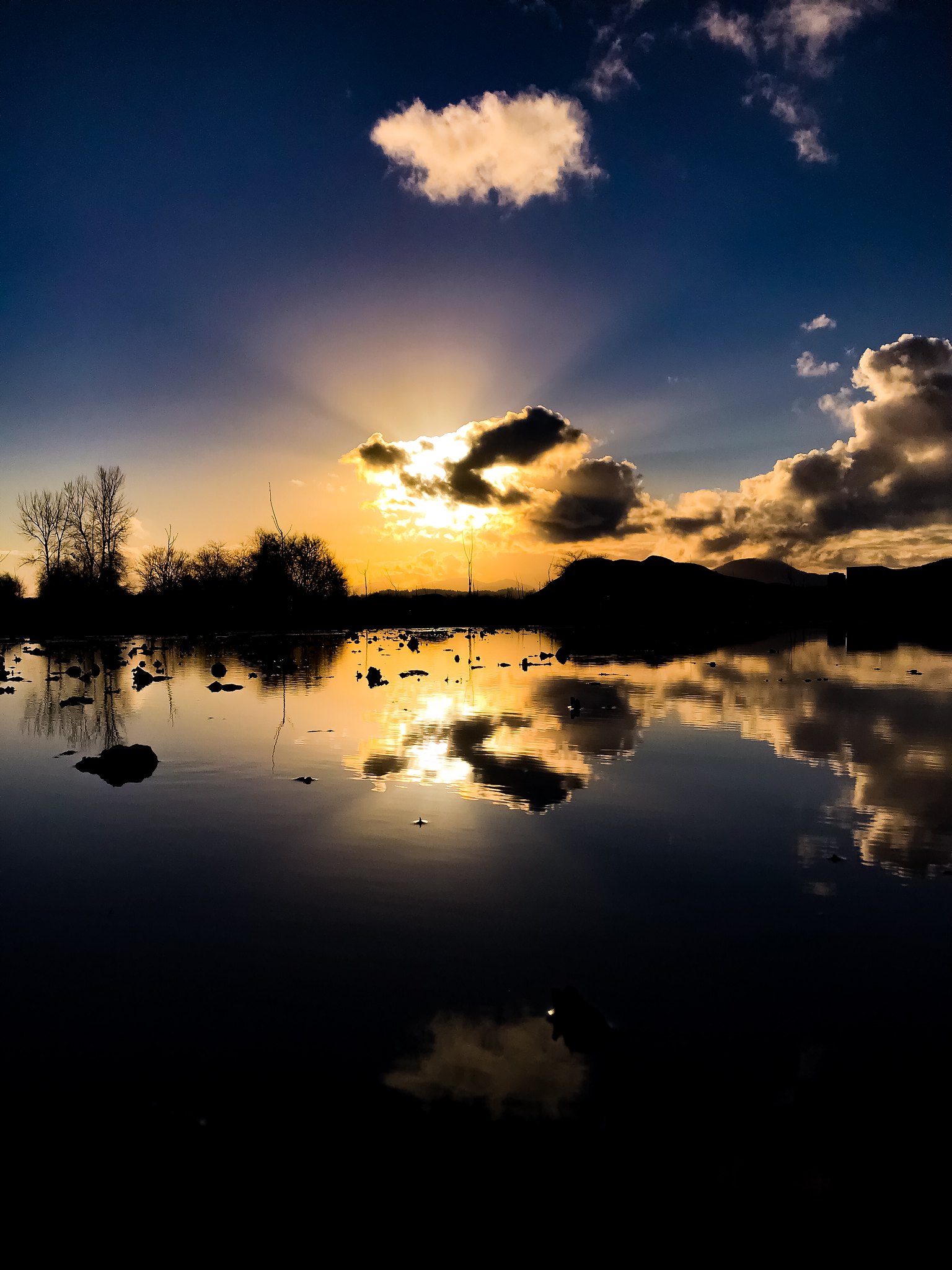
After sight seeing on the way up to the mountain on Friday, we decided to stop by the local market and make our own dinner in our kitchenette at the Mountain View Lodge. Two pro tips here: firstly, if you ever have the opportunity to get a place to stay that has it’s own kitchen – do it; especially when you’re in the heart of nature as we were. The produce is local, the meat is local – the community is small, and it feels good to be part of the local economy, and food chain. Secondly, marry someone that can cook. Danny whipped up a fantastic steak dinner with a side of greens tossed in the steak sauce, and oh my wow – it was the perfect end to a long day. We made some libations and took a stroll down to the river, where we were met with an 8PM sunset that danced along the shoreline. With colder weather recently, the river had a relaxing ebb and flow to it and we were joined by a pair of geese – fun fact here: geese mate for life, and seeing one while with your significant other is a wonderful sign of things to come as a couple. A perfect sighting for Danny’s birthday weekend.

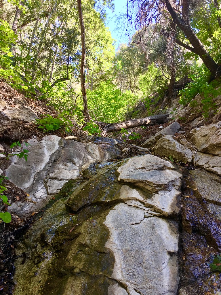
Saturday morning the sun wafted through the blinds, rousing us from a wonderful slumber – and we immediately took our coffee back to the edge of the Cowlitz River to kick the day into gear. As we reached the edge of the water, it was clear that the weather from Friday had caused quite a snowmelt as we were greeted with murmurs, gargles and bubbles from the water against the shoreline. Once we were properly caffeinated it was off, off and away into the mountains to check out Skate Creek Park. I must have sounded like the biggest city kitty in the world when I asked my husband “Wait, so there’s a skate park in the woods?” because apparently Skate is apparently a type of fish; and once upon a time, Skate Creek was actually stocked with catchable trout. With the continual steelhead and salmon reintroduction into wild waters, there are now State regulations which prevent the restocking of ‘catchable’ trout species in ‘anadromous’ waters; under this designation, this is any river, creek and waterway that fish use to come from the sea to release their eggs inland. The trail itself for Skate Creek Park is about 2 miles, and fairly easy to maneuver. For those (like moi!) that enjoy getting off the beaten path, there are ample locations to park your car next to the river, grab your gear and enjoy a private beachside picnic, or afternoon libations.

May be an image of 1 person, tree and nature

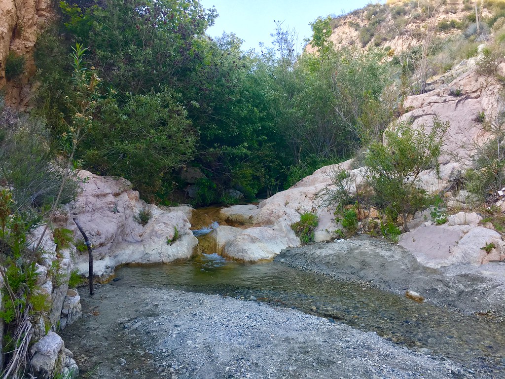
We tried to make it through the mountain pass, but sadly our little Civic wasn’t prepared to hit the bumpy roads and we turned around fairly fast so as to not get stuck there. We made a few more pit stops along the river, and just – wow. Because of the recent heat waves, the glacial ice was ripping and roaring around each turn, taking up technicolor hues of vibrant greens, teals, turquoises and blues; it looked good enough to drink! Paired with the lush vegetation on all sides, clear skies and warm sunlight on our shoulders – it truly felt like we were transported into Fern Gully or Avatar.

May be an image of 1 person, nature and tree

After heading back to the lodge and reassessing the situation, we decided on a quick lunch at White Pass Taqueria and Taproom and our stomachs couldn’t have been happier. Real good TexMex has been hard to come by outside of California, and White Pass went above and beyond; you honestly can’t go wrong with the selection of eats and treats and the outdoor seating is fantastic. Then it was off, off and away to explore new sights on the East side of Tahoma.

One thing we noticed during the journey is the optical illusion of mountain size. Maybe it’s the sheer grandiosity of it all the way from the heart of Seattle, or the University of Washington campus – maybe it was the fact we were already at an altitude of 2000 feet; but cruising along the base of the mountain, it seemed small for the very first time.

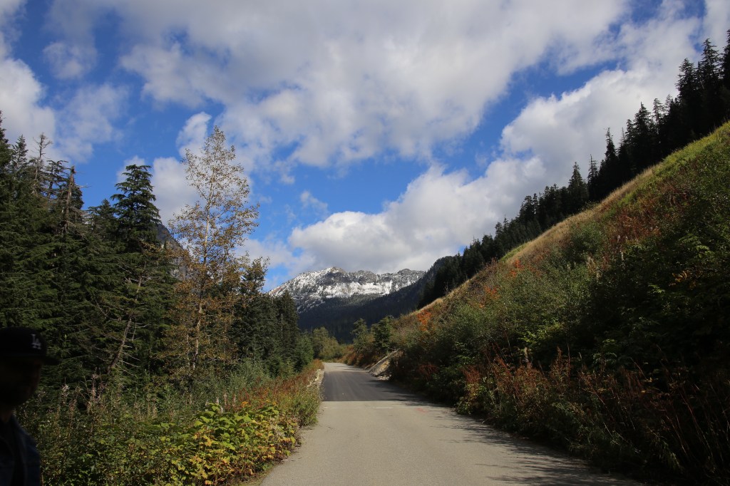
As we drove from Parkwood into Randle and Naches, Tahoma felt like a mountain out of Alice and Wonderland – eating this and drinking that, growing larger around one curve and then retreating in size the next. Beyond the popping in our ears, we could tell the elevation was increasing because there was ample snow on all sides of the mountain – an actual dream of a situation. Sunny, clear skies from above reflecting and refracting off of the snow in a cascading technicolor scheme all around us.

Winding around the 12 Highway, we slowed to a snails pace to fully take in the scenery: towering ridgelines of trees with sorted gushing waterfalls bellowing down to the next level, and the next, and another too far down to see on one side, while snow rimmed lakes danced with still reflections on the other.

May be an image of tree, mountain, lake and nature

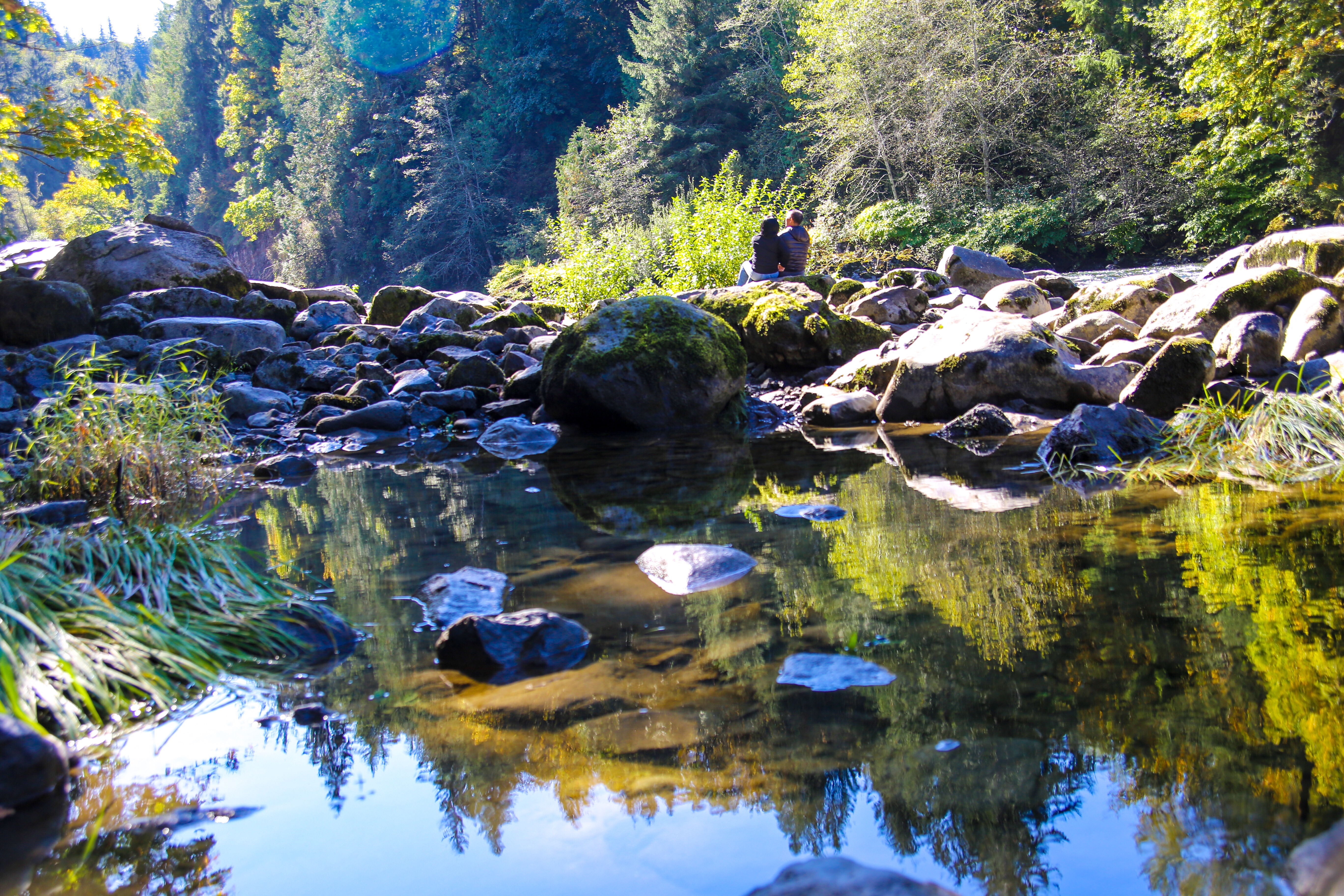
Finally, we stumbled into a doubly delicious lake situation with Clear Lake to the South and Rimrock Lake to the North of us and made an afternoon out of it. Hiking up and down the winding trails around the lakes, sitting on the shores edge and skipping stones in the crystal clear water while admiring the grandiosity all around. On the way out, we took the long way home – driving to the most northern edge of Rimrock, and soaking in sunset as we gradually descended down the mountain, admiring the view from all angles – grateful for the treasures Earth has to offer.

No matter how you get there, or which side of the mountain you choose to roam – there is something magical around every nook and cranny of Mount Rainier. For more, including current closures due to COVID, as well as Winter road closures as we head into the warmer months, head to their website or social channels – or put on your adventure pants, say “Fuck It!” – pack a bag, and plan a visit!

Website | Facebook | Instagram | Twitter | YouTube

May be an image of nature

“Everyone wants to live on top of the mountain, but all the happiness & growth occurs while you are climbing it.” 

Andy Rooney
May be an image of sky, lake and nature
May be an image of 1 person, lake, nature and tree
May be an image of 1 person, body of water, nature and tree

[Wander Washington] Searching for Swimming Holes along the Skykomish

When we first moved up to the Pacific North West a year and a half ago, one of the first things my husband said to me was: “Now, how do we get to those swimming holes?!” Both of us born and raised in California, myself from the Bay Area and him from the High Desert in Southern California – most of our aquatic adventures had been to the beach, or a community pool, or with water balloons in the backyard on a long, hot afternoon. When we lived in Oregon, we lucked out – our new neighborhood friends told us about a stellar iPhone app, aptly titled Oregon Swimming Holes. Now, there are some fantastic applications for Forests in the Pacific North West, as well those for Wildflower, Plant and Fungi Identification – but so far to date, I haven’t seen any remnants of anything similar up here; which initially felt disheartening – but then, we turned it into an adventure; making notes on maps, dropping pins and doing some research.

It wasn’t until weeks later, wrapped in a vibrant conversation with a local that we were slyly informed of where the getting was good. And now that I understand Washington, and Seattle, more and more, I think I know why there isn’t an app that’s easy-peasy, lemon squeazy: they want you to pioneer your own life, to be a maker of your own moments. Washington and Seattle are rich with a strong craft and small business community, and within that – there are strong notions of being able to do for your self, and make it self sustainable. If being told “It rains a lot!” is enough to deter you from either visiting, or moving, you’re probably not going to have a good time; but here’s a hint: it really doesn’t rain a lot! It’s actually beautiful most days, and if you don’t like the weather – just wait thirty minutes. Anyhow, I digress. So, we took their advice – pack up a picnic basket, grab a swimsuit, and take the 2 East; then, enjoy!

So, we took a Summer drive along the winding Skykomish River and let our wanderlust guide us the rest of the way. All along the freeway, there are hidden nooks and crannies where you can hop out of your car, and into the refreshing, roaring waters. Pro Tip: if you’re unsure where to stop, just look at where the other cars along the way are, then plan accordingly and don’t be afraid to double back! I recommend a solid pair of water shoes, as I managed to slice my foot pretty well on the side of a rock – but besides that, my only other piece of advice is to give yourself a whole day and really enjoy marinating in a magical slice of wilderness.

As we gallivanted along our route, a spotted sky gave way into gradients of bright blue, echoing the vibrancy of the lush forest against the rushing Skykomish. It felt like Fern Gully, or even Avatar – and could make you believe that fairy tales were real. Descending down to the waters edge, you could see to the bottom of the river as the water cascaded over, around and even through some of the ancient pieces of rock that were lodged in the river.

Walk in nature and feel the healing power of the trees.” – Anthony William

From Monroe to Gold Bar, Index, Baring, and the town Skykomish – as you head towards Eastern Washington, it feels like there are an infinite amount of places to get lost for a few hours, so that you can rediscover yourself at your core.

Where do you turn to find your next big adventure? Do you ask around, find an app, research in a magazine or just wing it? Let me know in the comments below!

[Wander Washington] Chasing Waterfalls on the Snoqualmie River

Catching Reflections in Cle Elum

With the turning of the Seasons here in Washington, Spring is kicking herself into a beautiful full bloom; and as we’re making it through another week of Stay in Place orders in Washington, I know I’m not the only one who is simply itching to get out of her home, back into the great outdoors, and lap up the wonders sprinkled around this fantastic state. Leaving California, one of the big motivators was proximity and access to nature – and let me tell you: up here in the Pacific North West – we’ve got that down.

The last grand adventure that I took, was with my family for my father’s birthday; we took a day to ourselves and gallivanted out of Seattle proper and to the East on Highway 90. Our journey took us along the Snoqualamie River, South of the Okanogan-Wenatchee National Forest into whimsical wonderlands just off of the beaten path; each bit lush with greenery, teaming with fungi, with offerings of waterfalls and scenic views at the end of each and every trail.

Snoqualmie Falls

We kicked off the day with a stop at Snoqualmie Falls, one of Washington’s most fabled tourist attractions. A member of the National Register of Historic Places, Snoqualmie Falls gained most of its notoriety by being prominently featured on the hit series Twin Peaks. The Falls offers a quick walk, descending down through old growth trees and a temperate rain forest and down to the rushing river below.

We visited in the beginning of October, which was lovely with the mix of light wind, succulent sunshine and the tiniest dusting of snow on the mountain ranges nearby. I was told the best seasons to really get the full effect of the Falls are between the end of Autumn and beginning of Spring as the water levels in the area rise.

From there, we headed further East towards North Bend. Under the ever shifting blue skies and shifting autumn leaves, we found ourselves pulling off at almost turnout we could to explore the abundant little nooks and crannies along the way, finally stumbling upon one of my still favorite finds.

As you duck under the canopy of the tree grove and into what feels like Avatar, you’re greeted by colorful fungi and the delightful sound of rushing water.

Inching closer to the sound, you’ll find a narrow trail with spritzes of water tumbling towards your direction. Finally, low and behold – the breathtaking beauty of Franklin Falls. As you descend downwards, closer and closer to the waterfalls – rainbows cascade from the spray and you’re immediately enveloped in a magical mist. There’s simply nothing like it.

After a few moments reveling in the rainbows and raindrops of Franklin Falls, we were off, off and away again, still due East – but this time with a vastly different intention: food. In Ellensburg right off the highway sits the Aardvark Express, a fantastic Korean-Mexican fusion foodtruck boasting some damn fabulous bowls; I highly suggest the Hurry Curry Bowl for any first timers.

With full stomachs and happy hearts, we were back on the road – this time coming home due West, but with just a few more stops to make on the way back.

The first was on the back-end of Snoqualamie Pass in the vastly different landscape of Cle Elum, The Heart of the Cascades. With several hikes and water features, including lakes, the area is the perfect summer spot for camping, recreation and outdoor activities, as well as water sports and boating. Maybe it was the time of year, or just where we decided to take our pit stop – but the landscape started to feel more and more like the desert of Easter Washington than the lush vegetation of the more Western regions.

Finally, last but certainly not least – we took ourselves wandering along the river in Olallie State Park in search of the infamous Twin Falls waterfalls, which contrary to what the name states – actually boast five fantastic falls, serene swimming holes and a cacophony of birds chirping their way through the woods.

Lately, I’ve been reliving my adventures through my photos because of the one two punch of ‘stay in place’ orders and park closures. When this current Coronavirus chas is over, I’m almost positive there will be a flood of people out to all of the parks and open areas – so please, be conscious of your physical distance, and please don’t go out if you’re sick However, if you’re anything like me I know you’re feverishly plotting your next outdoor adventure – where’s the first place you’re planning on visiting once you can? Let me know in the comments below!

For more information on the trails mentioned, peep the links below:

Snoqualmie Falls: Website | All Trails

Franklin Falls: All Trails

Cle Elum: All Trails

Olallie State Park, Twin Falls: All Trails

[Local Lore] Wild and Free at the William L. Finley Wildlife Refuge

Untitled

Tucked deep in the heart of Corvallis sits a whimsical wildlife habitat; a home to many seasonal creatures as they make their semi-annual migratory routes. Created back in 1964, the William L Finley National Wildlife Refuge is a preserved natural land area in the Oregon’s greater Willamette Valley and is notorious for the flocks of dusky Canada geese that frequent the landscape. Unlike typical Canadian geese, their dusky cousins nest and mate along the Copper River Delta in Alaska over the Summer and visit the vast acreage of wetlands of the Finley Wildlife Refuge during the colder, Winter months.

One of the last intact wet prairies in the area, the refuge was a reaction to the Great Alaskan Earthquake of 1964 which diminished the available natural land for dusky Canadian geese. Fast forward almost forty years and in 2006 the Snag Boat Bend Unit was acquired as a partition of the reserve, adding almost 350 acres of unique, historic habitat to the already sprawling 5,300 acres of wetlands covered by the Finley Reserve.

Untitled

Beyond the dusky Canadian goose, the William L Finley Wildlife Refuge also plays homebase for a variety of flora, fauna and fowl throughout the year with a handful of habitat regions on site, ranging from wet prairies on the East End to sprawling wetlands off of Muddy Creek, or to the upland Oregon white oak savannas and forests. On any given day, you could run into a menagerie of birds and waterfowl from migratory raptors like the rough-legged hawk to turkey vultures, peregrine falcons, golden and bald eagles, to great horned owls and geese, great blue herons, wood ducks and swans, woodpecker colonies and meadowlarks; not to mention the herds of Roosevelt Elk, blacktailed deer, coyotes and bobcats, alongside pond turtles, red legged frogs and the endangered yet recently re-introduced Fender’s blue butterfly.

Untitled

For a full spectrum of the Refuge, I highly suggest returning throughout the year. Even though Winter is wonderful to observe the migratory patterns of waterfowl, November marks the beginning of ‘Sanctuary Season’ which closes off the interior or the park for resting animals; the season end on April 1st, and all interior trails are opened once again.

Untitled

Whether you’re hiking, cycling or simply just observing the world at large, the refuge boasts a menagerie of looping trails and rolling hills throughout the grounds, offering over a handful unique hiking paths that cover over a dozen miles of land. For those looking to stay lazy, fret not – there’s an auto tour route with ample roads for roaming. Posted every now and again, you’ll find neat tidbits and educational facts on the nature and ancient nurture of the area.

Untitled
Untitled


Originally, the land was settled by the Kalapuya tribe – a conglomeration of thirteen related tribal groups speaking three distinct languages among themselves; each tribal group inhabited a specific area along and around the Willamette River. With the volcanic Cascade Mountains nearby, tribes around the river effectively fashioned obsidian  arrowheads and spears; if you look hard enough, you can still find obsidian artifacts and minerals in the area to this day – including in the grounds of the Wildlife Refuge. On the other end of history, is the Willamette Valley segment of the Applegate Trail, first used in the 1840’s – it’s a more southerly trail than the Oregon Trail sauntered through by European Settlers.

For more on the William L Finley Wildlife Refuge, head to their social channels – or simply go pay them a wonderful visit; I promise, it’s worth it!

What are your favorite spots to observe the wistful, wonderous wildlife in your town? Let me know in the comments below!

Website | Friends of the WLF Refuge | Facebook | Twitter

Untitled

[Nature is Nurture] The Fundamentals of Foraging for Fungi

Moving to a new city, let alone a brand new state, can be a harrowing task to say the least.  A move of any magnitude is a great time to spring clean the mind, but when you’re adjusting to an entirely different location I think it’s important that you take up some hobbies, both new and old, to ease yourself into your new environment while it becomes your new home.  Your old hobbies will get you back to basics, back to the core of you – it’ll remind you that home is and always will be in the sacrament of the mind and the spirit of the soul; while your new hobbies will transform your mental state into being present, letting go of the past and who you used to be in order to become who you need to be, who you desire to be.   My hobbies back in Los Angeles which are currently filed as ‘something old‘ include writing, sketching, photography, and beadwork; essentially home-based creative activities I could file under “things to do with my hands when bored”.

This image has an empty alt attribute; its file name is 44361204_1846267782138017_436499132610248704_n.jpg

Post-move, I’ve realized I’m not in Kansas anymore…er…rather, California anymore; I’ve gone from enjoying a keen understanding of the geography, topography and landscape of world around me to having a childlike sense of wonder and amazement about this new natural world around me, and suffice it to say – there’s simply so much to learn about, from nature photography on any of the hundreds of local hikes, to hunting for rare minerals, geocaching and my newest favorite – foraging for fungi.

As you learn to leave and let go of unnecessary mental connections to where you were,  you begin to forge new networks, shedding pieces of the life you once had to create yourself anew – mushrooms are very similar; with growth as their only form of mobility, fungi straddle the perpetual edge of life and death, not to mention animal and plant, all the while communicating as one in the  mycelial network.  Ranging from neutrally colored and more natural, to delightfully vibrant and oddly formed, Fungi are the primary decomposers of earth’s ecosystem, and a wild menagerie of them at that!

Many have medicinal qualities, which indigenous tribes historically as well as presently still use for a variety of treatments. Some boost the immune system, while others increase levels of antioxidants, or destroy abnormal cells; some stimulate the libido or assist in nerve regeneration, while others open the mind and aid in treating depression and anxiety. Some have magical qualities, featuring various doses of psychedelic psilocybin, boasting immense psychological benefits which are finally being taken seriously by the FDA

False Turkey Tail
Photo by Daniel Leist

These types of mushrooms are championed by the likes of Terence McKenna, infamously quotable ethnobotanist who gave us the ‘Stoned Ape Theory‘, internationally renowned mycologist Paul Stamets and the indelible Joe Rogan. 

For anyone that’s watched the latest Star Trek Discovery series, you might note that their chief medical engineer shares the same name as well as the same mycelial ideologies of the earthborn Paul Stamets, and follows his book Mycelium Running very closely; anyways – the trekkie in me digresses. Last but certainly not least – a small handful are incredibly toxic, deadly toxic if you will, with several mimicking their benign cousins.  This makes it  incredibly important that you do your due diligence when researching, and save snagging them for your meals until you have a keen understanding of harmful versus helpful mushrooms. 

Turkey Tail


“Mushrooms are a natural source of energy, immunity, and longevity that’s been studied for centuries. They are so great, that they’ve even earned the title of ‘superfood’.”  


Terence McKenna

They’re not animals and they’re not vegetation – so what exactly are fungi?  Fungi can then be separated into three distinct groups based on how they get their nutrients.  Mycorrhizal Fungi, which are symbiotic fungi, live in harmony with the plants around them.  On the other hand, Saprophytic Fungi live on dead organic matter instead of assisting in its decay. Finally, Parasitic Fungi are the cause of vegetative decay, as well as the recipients of all the nutrients. Mushrooms are considered the fruiting body of a variety of fungi, other types of fruits are algae and molds – but for the most part, fungi exists at a microscopic level that goes unseen to the human eye.  Fungi are used as antibiotics, to ferment food and alcohol, and even as detergent; you might be surprised at how many everyday items you use that have been treated with some form of fungus.

“Nature alone is antique, and the oldest art a mushroom.”


Thomas Carlyle

So, how about mushrooms? As the spore bearing, fruiting fungus body – mushrooms occur in technicolor and can take a menagerie of different shapes.  Young mushrooms, often referred to as buttons, are primarily a cap and a preformed stalk under a universal veil.  Over time, the cap will expand in an umbrella like fashion with either spores, gills, teeth or veins to show for its work while the stalk simultaneously gets longer. Some mushrooms have a cup at the base of the stalk which is often deep in the dirt – so when foraging, remember: dig, don’t pick!

Morphological characteristics of the caps of mushrooms

If you weren’t already sold on mushrooms, here’s a few facts that make them even more amazing to me.

This image has an empty alt attribute; its file name is 44545021_1141989825956056_1419659220164280320_n.jpg

Foraging for Fungi

So, now that you’re more up on your mushroom game – let’s talk about the best tips and tricks for finding those fungi and hunting down some of the coolest creatures on our planet.  The best thing about this type of hunt? No weapons necessary – just some keenly attuned eyes and your roaming feet. 

  • Location, location, location
    • If you notice one visible mushroom, the fruiting body of the fungi, take a step back and see if you can notice any others.  Mushrooms populate in a line, or rather, a circle stemming from a fungal epicenter.
  • Timing is everything
    • The rain brings good things, including the proper climate for mushroom hunting.  Depending on where you live, California and Oregon see their season at the beginning of Fall and Winter (but really, it’s pretty year round in Oregon), while the East Coast has its best seasons around early Spring. A rule of thumb is to wait two weeks after two inches of rain have accumulated. 
    • As a side note, time of day is equally important as many fungi will only fruit once the temperature starts to drop
  • Let a little sunshine in
    • Though fungi notably prefers dimly lit or dark atmospheres, light will inspire fungi to produce mushrooms 
  • Check the soil
    • As natural decomposers, mushrooms enjoy disturbed dirt – so make note of the floor of whatever forest you’re lurking in
  • Learn the Flora and Fauna
    • Most mushrooms have affinities towards specific weather conditions, as well as specific types of trees.
    •  For example, king boletes enjoy spruce, pine, oak and birch treeschantrelles prefer conifers  and oyster mushrooms will defer to aspens.

Things to Bring

  • A picnic basket or a few paper bags to put your keep in
    • For those wanting to ID a variety of fungi, snag a small tackle box to keep each kind separate
    • For those going the picnic basket method, leave the bottom open for the mushrooms to spore as you travel so the next explorer can enjoy them as well!
  • A small hand shovel so you can get the whole mushroom
  • GPS kit or rope / yarn to mark you path so you don’t get lost
    • You don’t even want to know how many people get lost in the woods every year searching for mushrooms, so please don’t be part of the statistic.
    • The Gaia GPS app is an excellent resource if you’re willing to get the Pro version!
  • Put the fun in fungi and remember to enjoy yourself!

When you find your magical, mystical mushrooms – document that sucker! Take a few photos that accentuate the colors of the top, the bottom of the cap – to see what types of gill or pore the fungi boasts, and the stalk of the mushroom – then step back and get a photo of the scenery; if your phone doesn’t geocache your location for each image, or you don’t want it to – trust me I get it,  drop a pin in your map application with a note about what you found so you can come back and see how it’s grown. 

I can’t stress this point enough: even though many fungi are fun to spore on paper and there are a good amount that are both edible and tasty, like I mentioned earlier –  be very wary! Collect what you will and document it all, but not just are some fatally toxic, but others will give you awful indigestion and a good amount simply taste downright awful and you won’t want anything to do with them post-pick or post-pic.  

Resources for Mushroom Lovers

General Books

Redwood Coast / Oregon Specific Books

Apps

As this is the modern age and it’s a bit untoward to carry around dozens of nuanced encyclopedias – I’m accumulated a list of amazing smart phone apps to try while on the go.  Most seem to be bi-phonal, but I’ll make a note when certain ones are unavailable to either vertical.

Mycelial Networks

One things for sure, if foraging for fungi is fun alone – imagine how great it could be with the right company! From Facebook groups devoted to the Pacific Northwest to National groups, here’s some of my personal favorites.

What are some of the best tips and tricks you’ve learned for fungi foraging? Let me know in the comments below!

Mushroom, Fungi, Oregon, Nature

[Traveling Tales] Take it to the Top: Conquering Gray’s Peak Trail

Image may contain: one or more people, sky, tree, outdoor, nature and water

“You might not find any wifi in the forest, but I promise you’ll find a better connection”

For the better part of the last decade,  any weekend with time to spare and sun to catch magically evolved into a festival fueled adventure somewhere along the West Coast.  Over the last few years, our festival family reunion and pre-Summer kickoff was Lightning in a Bottle – delightfully and delectably getting us ready for the rest of festival season.  When the time came this year to figure out where we wanted to lounge lavishly and enjoy each others company, we took a long hard look at the growth we’ve elicited from ourselves at Lighting in a Bottle – which comes easily when you’re surrounded by the prismatic love, light and laughter of the event.  Each year, though challenging for individually unique reasons, provided the perfect platform to acknowledge myself in the moment and grow from it.  Paired with sweeping landscapes and myriads of magical music, I almost dare you not to be moved – because I have been, over and over and over again.

Even as I describe what we didn’t experience this year, I feel blessed and gifted with my past experiences.  As I marinate in my own newfound maturity, I amuse myself in what I’ve become – knowing full well that growth is synonymous with growing pains, and I effectively feel like I’ve graduated from a phase of my life, and of myself.   All together, these thoughts synthesized themselves in a way that made me opt for a new journey for Memorial day this time around the sun. So, instead of feverishly packing our apartment to fit inside a tent, we packed an overnight bag and it was off, off and away to Big Bear for a weekend of sun and fun with a few friends that have become a hell of a lot more like family over the last few years.

Image may contain: one or more people, people standing, tree, shorts, shoes, sky, outdoor and nature

Just a hop, skip and a few hour drive into San Bernadino, Big Bear already sits at an elevation of nearly 7,000′ – even before you head out on your hike or snow inspired romp through the woods, and has a little bit of something for everyone – granted that everyone’s a bit of a nature nut.   We might have cut our lodging options short by not planning our trip until literally three days before the weekend, but thanks to AirBnB finding an a beautiful place to stay  – fully equipped with patios and a hot tub on a budget – was super easy.

After to getting into town late Friday night, on Saturday morning the group made a bomb little breakfast and got to packing for our hike.  Several sandwiches, a few mixed drinks and some salacious snackables later and we were off, off and away for what turned out to be an intense but well worth it hike up Gray’s Peak Trail.   All together, the hike up Gray’s Peak is about Seven Miles each way with 1300′ to climb in elevation.  One thing we didn’t know beforehand, but damn well are sure of now: at about 8000′ in elevation is when people start toying with altitude sickness and at approximately 8300′ – at times, you could really tell that we weren’t in Kansas at sea level anymore.

Image may contain: one or more people, people standing, tree, outdoor, nature and water

Even though the few websites we found on the hike claimed that it was great for kids, my friends and I can attest that those kids must be jacked up on Mountain Dew because we all had our collective asses handed to us.  There were a lot of fun ‘turnouts’ – if that’s what they’re even called if you’re not in a car – that got us to jump off the beaten path and forge our own trail, but in a respectful way – of course.  There were a few places with tiny streams, stemming from the base of the mountain and loads of little lizards running amuck every which way.  Near 8k’, you could tell that the trees were starting to be weathered under the altitude but that all changed when you got near the pinnacle, it literally felt like you’d walked through a portal and into Fern Gully.   There’s a couple things that make this a Summer hike in my book – like the incline and the potential weather, but it also turns out that the trailhead is closed for public use between December and April because it’s in the middle of a bald eagle wintering habitat area – how effing neat!

Packing Pro Tips

Make sure everyone has enough water, and a backpack between two people is perfect.  Layers, extra socks, hiking shoes cause you want your ankles.

Things I’ve learned as a novice hiker, but expert adventurer:

  • Cameras are always a must, sure your phone has one – but point and shoots are fun, too! Make sure you take at least one group photo before you head up the trail and into the sweat zone – yeah, now you get it.  Extra points if you remember to bring a collapsible tripod – you’ll really be your groups MVP, most valuable photographer.
  • Your phone has a compass on it, don’t be afraid to use it – but also, put that thing away and enjoy the hike!
  • Hydration is key, super key. Drinking and hiking is fun, but in the Summer it’s not the smartest – make sure you’ve got enough water for the walk up, and the walk back; plus, being more hydrated makes the drunk more fun – if you’re into that type of thing 😉
  • A bag per every two people is appropriate, that way you can also switch off with carrying duty – make sure you toss in some sammies and full bars for meals, and for snackables both nuts and dried fruit have a lot of protein.  Last, but not least if you’re weird like me and don’t really enjoy chewing – throw in a few ensures to top it off.
  • Everybody loves layers – especially for hikes.  Bring an change of socks in case you encounter water, shorts / pants depending on what you start off in and a hoodie.
  • Do a gut check with everyone before the hike starts and make sure everyone’s comfortable with the adventure ahead, you never know who’s in super great shape, or who might have some hesitations about an all day excursion.
  • Leaves of three, let them be. Poison Oak is no joke and usually it’s kept off the trail – if you’re like me and like to forge your own path, know what it looks like…or better yet, just wear pants.

Image may contain: 1 person, smiling, standing, tree, sky, outdoor and nature

For more on Big Bear, head to their website or social channels:

Website | Facebook | Twitter 


[LA Life] Adventure Along the Angeles Crest Scenic Highway

Image may contain: sky, mountain, plant, cloud, nature and outdoor

Mother’s Day Weekend is a special weekend, a fruitful time for family and a fitting occasion to embrace the divine feminine, and within that – our true Mother – Earth, Nature, Gaia – if you will.  As Danny and I gallivanted away this past weekend to go spend some quality time with his mom in Lancaster, we had (what we considered) a brilliant idea: instead of taking the 14, let’s take a leisurely drive through the Angeles Crest Highway.  And what a magical adventure that became.

Adventure Along the Angeles Crest Highway

The Angeles Crest Highway is often referred to as the ‘Highway to the Heavens‘, and in my opinion – rightfully so: just one cruise through it’s winding trails, your car eagerly hugging the curves and you’ll be confused if you’re still in Los Angeles, let alone California – or the United States.  At times, the drive reminded me of Zion, my fiance kept thinking of the Grand Canyon and it’s easy to think that you’ve instantly been transported to the Swiss Alps or somewhere picturesque in the South of France.

Adventure Along the Angeles Crest Highway

Considered one of the most beautiful non-coastal drives in the United States, the Angeles Crest Highway spans the northern most portion of California State Route 2, reaching from the the tip of Los Angeles County in La Cañada-Flintridge to Wrightwood in the heart of the San Gabriel Mountains.  Wander along the winding roads and you’ll find picturesque views of every angle of Los Angeles from the ridge-line of the Angeles National Forest.

The area is befit with a rich history that dates back to the turn of the 19th Century, and boasts plenty of turnouts with epic views, and hiking trails for those willing to adventure. And with nature just off of a stunning Superbloom season – or as I’d like to think of it, still marinating in the tail end of it, the hills are currently lush with bright yellow, violet and pink blooms.

Adventure Along the Angeles Crest Highway
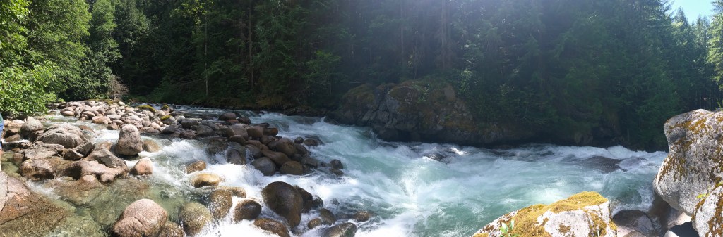
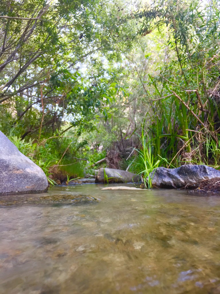
Stopping literally at every turn out we could – because, why not?! – we quite accidentally took a hearty nature break where Mill Creek intersects with the scenic byway.  As Danny found himself enamored by the tunnel born out of the mountain slabs, we were stopped in our literal tracks by the serene sounds of a bubbling brook. Danny eagerly clamored down the hill, reveling in the diamond in the rough that we just discovered – I was busy freezing in my flip flops, overthinking my way down to the water’s edge. After negotiating, and then poorly navigating my way down – spoiler alert: I slipped several times anyways – it was absolutely worth it.
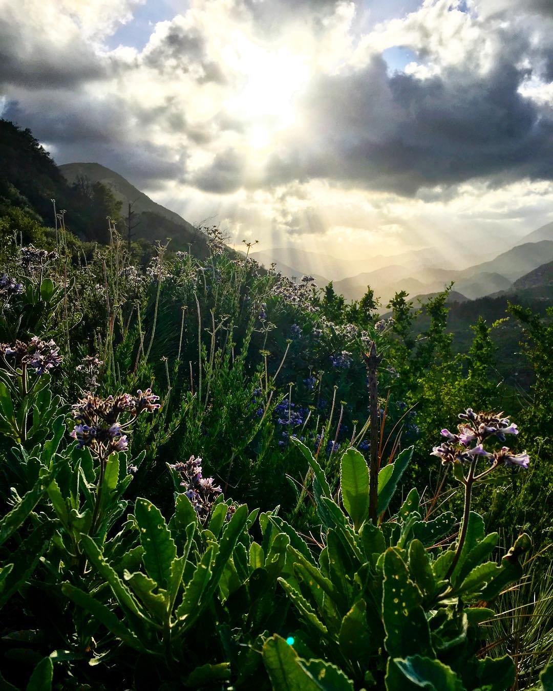
Because we live in the wonderful Mediterranean climate of Southern California, it’s pretty much always a good time to go for a drive on the Angeles Crest Highway, but during the winter months (and some awkward days of June gloom), the snow can shut down parts of the mountain pass and the fog induced poor visibility is actually terrifying – just trust me on that one.  So, before you hop in your car and ride away into the sunset – make sure you check the road conditions to ensure a smooth, beautiful drive.

There’s something absolutely sacred about the way a car hugs a tight turn along a scenic cruise, whipping the soul around to enjoy a palpable, panoramic landscape in a heartbeat; albeit I think the windows should be down and music up to take full advantage of the moment – but who am I to tell another soul how to enjoy a leisurely, weekend drive.

Take a peek at my recent adventures on Flickr!

For more on the Angeles Crest Highway, peruse their website and social media channels – or just take yourself out for a spin; trust me, it’s worth it – and you can thank me later.

Website | Facebook


Adventure Along the Angeles Crest Highway

Adventure Along the Angeles Crest Highway

Adventure Along the Angeles Crest Highway

Adventure Along the Angeles Crest Highway